我々はいつまで地表で生きていけるのか?
地球温暖化、オゾン層の破壊と地表オゾンによる健康、植物への被害。地球規模で取り組むべき課題だと分かっているのに一向に進まない現状に、地底人になるのかもと危惧しています。
火星または他の惑星に移り住むのと地球放棄、時間との闘いです.
地球を吸い尽くす人類、
豊かさと利便性への欲望、永遠にenoughは来ない?
金への欲望, いつになったらenough?
自然は永遠?
今日のVAOニュース!!
研究 : 北半球ではオゾン汚染物質の増加が続いている
Study: Ozone Pollutants Still Increasing in Northern Hemisphere
新しい研究では、地球の下層大気中のオゾン汚染物質が、過去20年間で北半球全体で増加したことが明らかになりました。
オゾンは酸素の一種である。地球の上層大気では、太陽からの有害な放射線を遮断するバリアの役割を果たしている。しかし、地表に近いところでは、オゾンは一般的な汚染物質です。地上レベルでは、高レベルのオゾンは、人々の肺に害を与えたり、植物にダメージを与えたりする可能性があります。
このデータを収集したのは、全地球観測システムのための就航中の航空機と呼ばれるヨーロッパの研究プログラムです。このプログラムでは、飛行中の大気の状態を測定するための機器を民間航空機に装備しています。Science Advances誌に最近発表されたこの研究は、旅客機からの情報を利用した初めてのものです。
研究を実施したのは、環境科学研究協力研究所(CIRES)で、国立海洋大気庁(NOAA)とコロラド大学ボルダー校が提携しています。
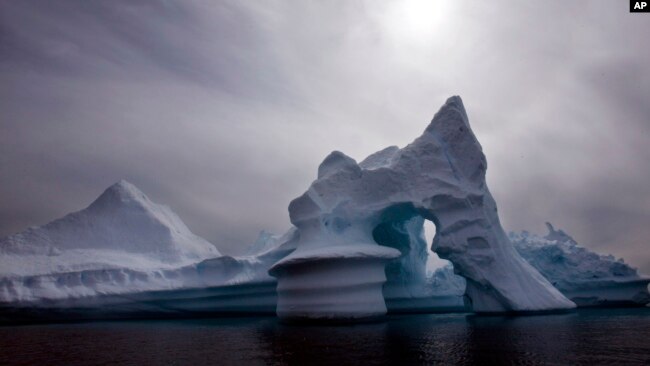
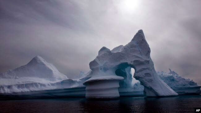
この2007年7月19日のファイル写真では、氷山は、東グリーンランドのアンマッサリック島沖で見られています。北極圏は過熱防止のサーモスタットであり、変化のバロメーターですが、現在、有害な紫外線を遮断するオゾン層が記録的なレベルにまで薄くなっていると、国連気象機関が2011年4月5日(火)に発表。(ジョン・マッコニコ、AP通信)
研究者たちは、世界中の6万回以上のフライトからオゾン観測を利用しました。科学者たちは、北半球の5つの地域ー米国北東部、ドイツ、インド、東南アジア、中国東北部、韓国を中心に調査を行いました。
北半球が研究対象となったのは、大気質の影響を受ける人口の割合が大きいためです。
この研究では、過去20年間で地球の大気のほとんどの部分でオゾンレベルが上昇していることがわかりました。
しかし、研究者たちは、北米やヨーロッパを含むいくつかの地域で地上レベルのオゾンが低下していることを報告しました。しかし、これらの結果は、大気中のより高い位置でのオゾンの増加によって打ち消されたと研究者らは述べています。
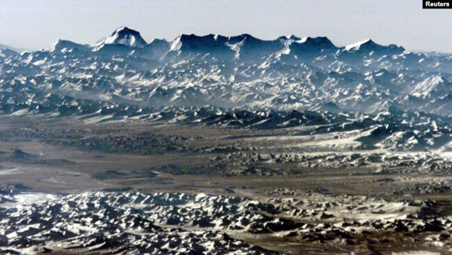
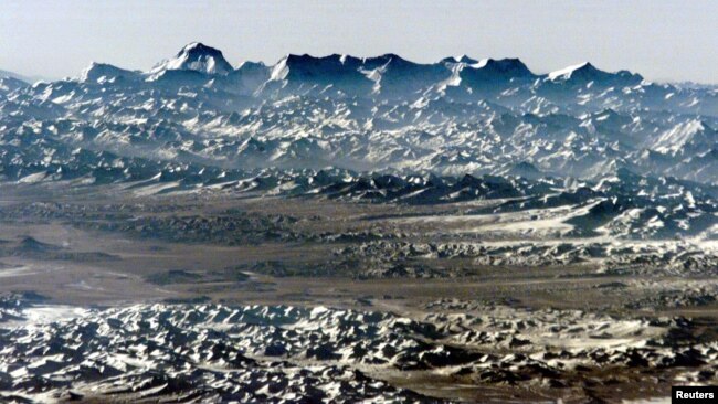
FILE - 国際宇宙ステーションからの第1次長期滞在クルーが高倍率レンズを使って撮影したこの画像には、世界で7番目に高い標高26,794フィート(8,167メートル)のドーラギリ山がスカイラインを支配している。
この研究の主執筆者はオードリー・ゴーデル氏です。彼女はNOAAの化学科学研究所で働くCIRESの科学者です。この結果は、彼女の言葉を借りれば、「局所的な汚染を制限しようとすると、思っていたほどうまくいかないかもしれないということを意味しているので、大変なことです」とのことです。
ゴーデル氏は、国際航空機によって収集されたデータは、長期間にわたる北半球のオゾンレベルの明確な画像を作成する上で非常に貴重なものであると述べています。他の長期的なデータ収集方法では、オゾンの結果に矛盾が生じていました。同氏は、1994年から2016年までの間に、民間航空機の飛行機が3万5,000近くのオゾンプロファイルを捕捉したと指摘しています。
研究チームはこのデータを用いて、1990年代半ばから2016年までの大気下部オゾンの変化を推定しました。平均して、オゾンの値は10年ごとに約5%上昇していました。
この変化の原因を探るために、科学者たちは窒素と酸素の混合ガスである窒素酸化物のレベルを調べました。窒素酸化物は、人間の活動に起因する大気汚染物質と考えられています。
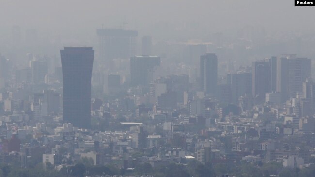
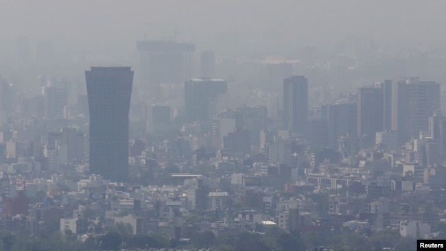
2016年3月14日、メキシコシティでスモッグに包まれて立つビル群。(REUTERS/Edgard Garrido)
研究者たちは、航空機のデータを使って、窒素酸化物の放出が大気の状態にどのような影響を与えたかを推定するモデルを作成しました。その結果、赤道に近い熱帯地域での窒素酸化物の放出の増加が、”北半球で観測されたオゾンの増加を牽引している可能性が高い”ことが示唆されたといいます。
チームによると、オゾンレベルがかつて最も低かった地域で最も急激な増加が見られたといいます。これには、マレーシアやインドネシア、東南アジアの他の地域、インドなどが含まれています。これらの地域では、1994年から2004年の間はオゾンの値が非常に低かったのですが、近年2011年から2016年の間に非常に高いレベルになっているのです。
次に、ゴーデル氏は、彼女のチームは熱帯地域のオゾンレベルをより詳しく調べることを計画していると述べています。彼女は、アフカは、今後数年間で汚染物質の放出が増加する可能性のある”ホットスポット”として注目すべき地域の一つになるであろうと考えているのです。
オゾン層
上空に存在するオゾンを地上に集めて0℃に換算すると約3ミリメートル程度の厚さにしかなりません。 このように少ない量のオゾンが有害な紫外線を防いでいます。
地上でオゾンは、大気汚染物質・光化学オキシダントの主成分で、光化学スモッグを引き起こす。温室効果ガスでもある。農作物や木に被害を及ぼすこともわかってきた。
Study: Ozone Pollutants Still Increasing in Northern Hemisphere
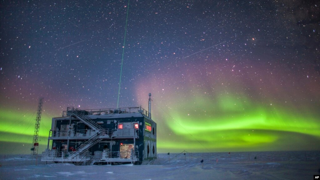 This undated photo provided by NOAA in May 2018 shows aurora australis near the South Pole Atmospheric Research Observatory in Antarctica.
A new study has found that ozone pollutants in Earth’s lower atmosphere increased across the Northern Hemisphere over the past 20 years.
Ozone is a form of oxygen. In Earth’s upper atmosphere, it acts as a barrier to block harmful radiation from the sun. But closer to Earth’s surface, ozone is a common pollutant. At ground level, high levels of ozone can harm people’s lungs and damage plants.
A European research program called the In-Service Aircraft for a Global Observing System collected the data. The program equips commercial aircraft with instruments to measure atmospheric conditions during flight. The study, published recently in Science Advances, is the first to use information from passenger planes.
The Cooperative Institute for Research in Environmental Sciences (CIRES) carried out the research. It is a partnership of the National Oceanic and Atmospheric Administration (NOAA) and the University of Colorado Boulder.
The researchers used ozone observations from more than 60,000 flights worldwide. The scientists centered on five areas of the Northern Hemisphere – the northeastern United States, Germany, India, Southeast Asia and Northeast China and Korea.
The Northern Hemisphere was studied because it contains a large percentage of the human population affected by air quality.
The study found that overall, ozone levels in most parts of Earth’s atmosphere increased in the Northern Hemisphere during the past 20 years.
The researchers did, however, report lower ground-level ozone in some areas, including North America and Europe. But they said those results were canceled out by increases in ozone higher up in the atmosphere.
Audrey Gaudel was the lead writer of the study. She is a CIRES scientist working in NOAA’s Chemical Sciences Laboratory. The results are, in her words, “a big deal because it means that as we try to limit our pollution locally, it might not work as well as we thought.”
Gaudel said the data collected by international aircraft was very valuable in creating a clear picture of ozone levels over the Northern Hemisphere over long periods. Other methods of long-term data collection have produced conflicting ozone results. She noted that between 1994 and 2016, commercial aircraft planes had captured nearly 35,000 ozone profiles.
The research team used the data to estimate changes in lower atmospheric ozone from the mid-1990s to 2016. On average, ozone values increased about 5 percent every 10 years.
To explore what was causing the changes, the scientists examined levels of nitrogen oxides, a mixture of gases made up of nitrogen and oxygen. Nitrogen oxides are considered to be atmospheric pollutants often resulting from human activities.
The researchers used the aircraft data to create models to estimate how nitrogen oxide releases affected atmospheric conditions. They said results suggested that increased releases in the tropics, the area close to the equator, “were likely driving the observed increase of ozone in the Northern Hemisphere.”
The team said it found some of the sharpest increases in areas where ozone levels were once the lowest. These included Malaysia and Indonesia, as well as other parts of Southeast Asia, and India. Those areas had very low ozone values between 1994-2004, but very high levels in recent years, between 2011-2016.
Next, Gaudel said her team plans to take a closer look at ozone levels in the tropics. She thinks Africa will be one area to watch as a possible “hot spot” of increasing pollutive releases in coming years.
_______________________________________________________________
Words in This Story
commercial – adj. related to buying and selling things
profile – n. a set of data that describes the significant features of something
hot spot – n. a place with more than the usual amount of interest or activity