最近日本も各地で地震のニュースを多く耳にするように思います。
4つものプレートの上にある地形から、そもそもしかたないことですが。
関東エリアでは、東北大震災の余震との報道もありますが、長く続くのですね。地震の解明がまた一歩進むといいですね!
”TSUNAMI”は世界語!!
VOAで英語を学び、知識を深めましょう!!
Investigators Look for Answers to Southern Ocean Earthquakes
研究ツールは、昨年1年間かけて地球の中心に向けられました。科学者たちは、得られた情報がオーストラリアやニュージーランドの人々の津波への備えに役立つと考えています。この地域は、地震活動が非常に活発であることから、“Pacific Ring of Fire” ”環太平洋火山帯”と呼ばれています。
このプロジェクトには、カリフォルニア工科大学、イギリスのケンブリッジ大学、オーストラリアの他の大学が参加しました。この情報が他の海にも応用できることを期待しているそうです。
Investigators Look for Answers to Southern Ocean Earthquakes
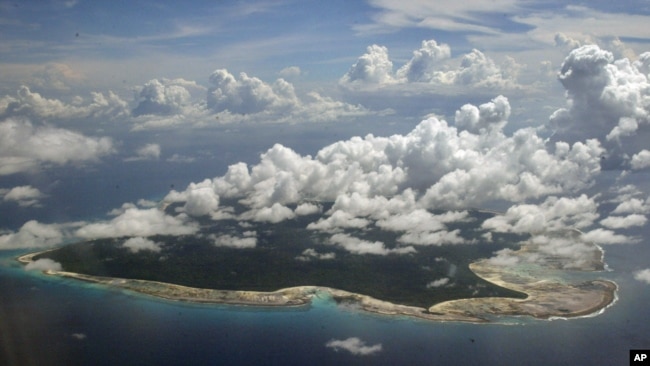
A aerial view of North Sentinel Island, in India's southeastern Andaman and Nicobar Islands. A tsunami in this area after an earthquake killed about 3,500 people in 2004. (AP Photo/Gautam Singh)
Some of the strongest earthquakes in the world come from the ocean floor south of Australia. The area is called the Southern Ocean.
Researchers placed 27 instruments known as seismometers on the ocean floor to find out why. Some of them were over 5 kilometers below the water surface.
The instruments have been recording earthquakes for the last year and are now being picked up. It will take three weeks to get them all.
A professor from the Australian National University’s School of Earth Sciences hopes the information will give more data on how and why earthquakes happen.
Hrvoje Tkalčić said more information about how and when earthquakes happen might help scientists predict how far seismic waves will travel afterward. The information could be useful to warn about strong highwater events called tsunamis.
He said scientists will not be able to predict earthquakes or how large they will be, but the project will help them understand the structure of the earth in the volatile area.
The research tools spent the last year pointed toward the center of the Earth. Scientists think the information they get will help people in Australia and New Zealand prepare for tsunamis. That area of the world is known as the “Pacific Ring of Fire” because there is so much seismic activity.
California Institute of Technology, The University of Cambridge in England and other Australian universities worked on the project. They hope the information can be applied to other oceans.
Words in This Story
tsunami – n. a very high, large wave in the ocean that is usually caused by an earthquake under the sea and that can cause great destruction when it reaches land
volatile – adj. likely to become dangerous or out of control
seismic – adj. of, relating to, or caused by an earthquake
火山の揮発性成分
https://www.nhk.or.jp/sonae/column/20120811.html
https://www.nhk.or.jp/sonae/column/20120811.html
上記サイトより抜粋編集
噴火の大きさを左右する揮発性成分
マグマに含まれる成分の中で量的には非常に少ないものの、火山噴火に大変重要な役割をするのが水、炭酸ガスといった揮発性成分です。地表のマグマはほとんど揮発性成分をとけ込ませることはできませんが、圧力が上がるにつれてマグマ中にとけ込める揮発性成分の量は増大します。マグマが地下深くにあるときは高い圧力がかかっていますから、マグマの中に水や炭酸ガスは完全にとけ込んでいます。
マグマから二酸化炭素などの揮発性成分が気泡として分離します。二酸化炭素はマグマ中に数%程度含まれる水と異なり、マグマ中の溶解度が低く水の100分の1程度なので、もともと発泡直前の状態にあり、わずかな減圧によっても容易に飽和して発泡しやすいのです。
このような発泡が起こると、マグマの密度は低下するので、マグマだまりで密度的に中立状態にあったマグマが浮力を得て上昇を開始することになります。マグマが上昇して浅い場所に移動すると周囲の圧力が下がるので、マグマの減圧が生じてさらに発泡が促進されます。こうなるとマグマはさらに浮力を得てもっと浅い場所に移動するという、いわば“正のフィードバック”がかかることになります。
ただし、このように地震がきっかけでマグマが発泡し上昇を始めても、マグマ中の二酸化炭素量は多くないため、得られる浮力もそれほど大きくなく、最終的に地表に到達して噴火するまでにはかなりの時間がかかることもあります。地震発生後、噴火が誘発されるまでに数年を要したケースが見られるのは、このようなメカニズムによるためかもしれません。
